It's no wonder Google Maps is by far the best navigation app available today. But beyond the usual navigation features andPath options And real-time traffic information, Google Maps also offers some unique features like: Location record The ability to measure distances and areas. In this article, we will review how to measure distance and area in Google Maps.
While Google Maps already lets you measure the distance of your trip by different modes of transportation, it can also measure distances between different points or even calculate the area of any property on the globe.
We'll show you how this feature works on mobile and PC. Let's get started.
How to measure distance in Google Maps on a computer
Whether you're trying to calculate distance along a straight line or a more complex route, measuring distances on the Google Maps web app is incredibly simple. Here's how it works.
Step 1: Open Google Maps in a browser on your computer.
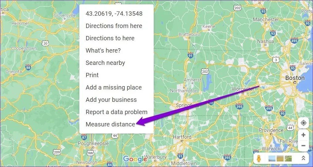
Step 2: Right-click anywhere on the map and select the Measure Distance option.
Step 3: Drag and drop the point that appears to select the starting point.
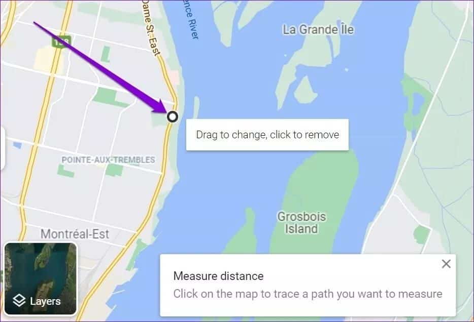
Step 4: Next, click on the second point (end point) on the map, and Google Maps will display the distance measured in kilometers and miles.
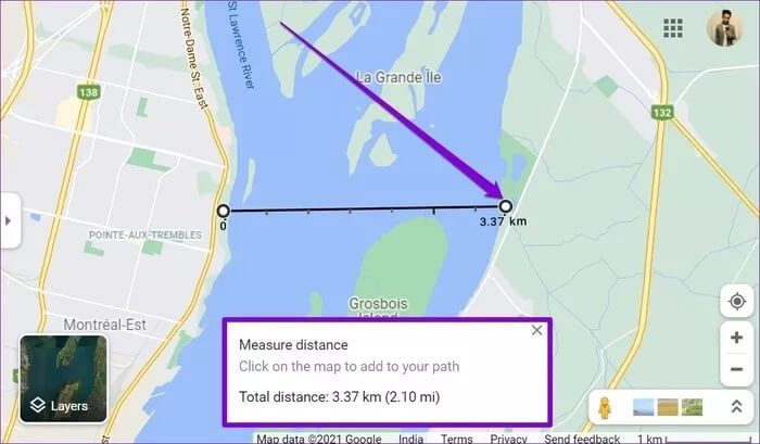
Similarly, you can select more points on the map to plot a more complex route. As you continue selecting points, the distance between the starting and ending points will adjust accordingly.
Advice: While picking points, you can zoom in/out on Google Maps to pick points precisely.
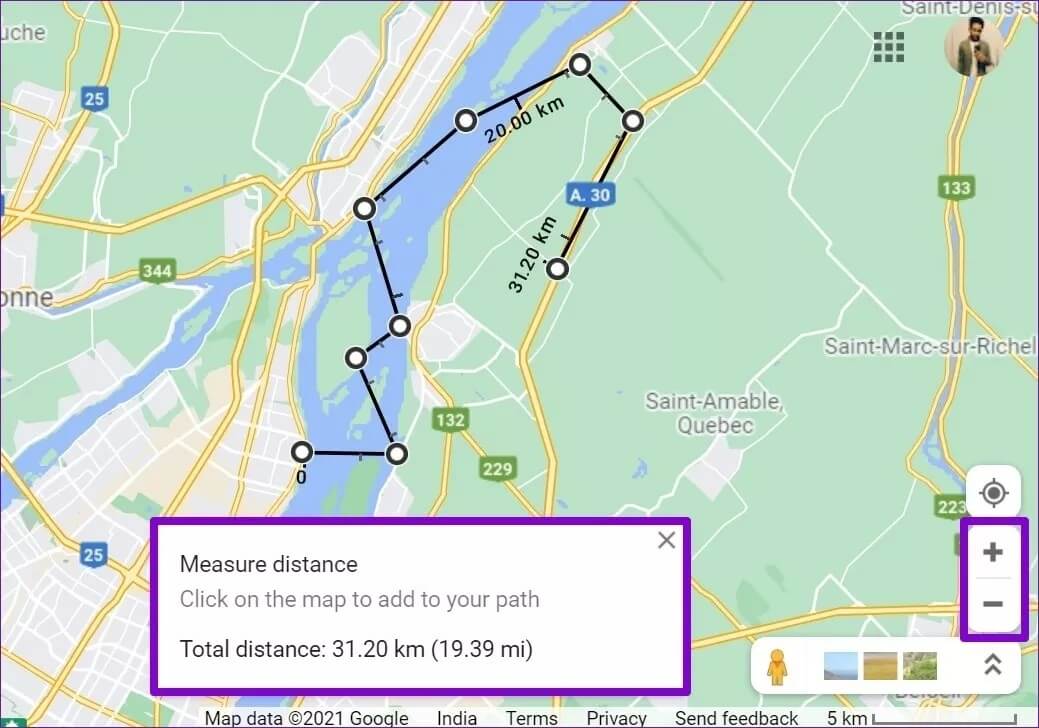
If you accidentally select the wrong point, click the point again to remove it. Similarly, you can also drag and drop lines to adjust the path.
How to measure distance in Google Maps on mobile
Like its web version, you can also measure distances using the app. Google Maps On your iPhone or Android device. Here's how.
Step 1: Open the Google Maps app on your iPhone or Android device.
Step 2: Press and hold the starting point on the map where you want to measure the distance. A red marker will appear at the starting point.
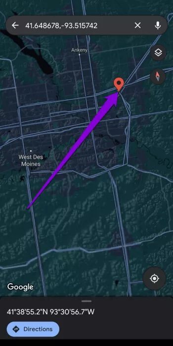
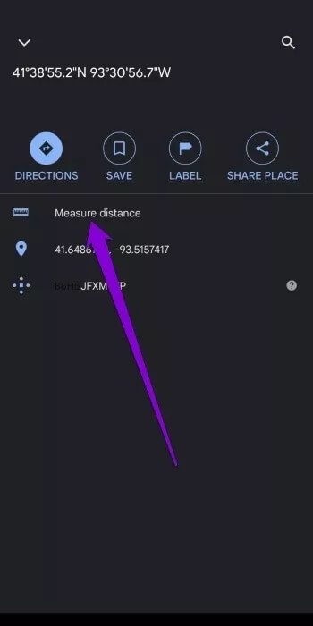
Step 3: Click on the location details for the starting point below and choose the Measure Distance option.
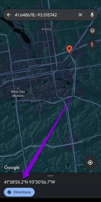
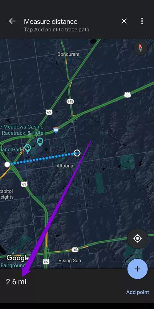
Step 4: A second point will appear above the first. Move around the map to locate a second point. Once you do, the distance will be displayed at the bottom.
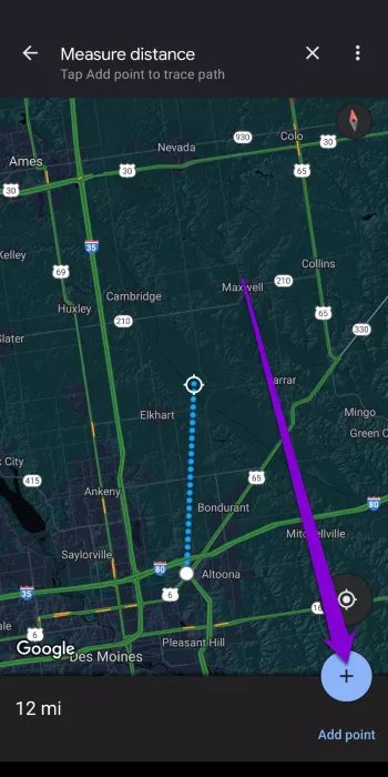
Step 5: Similar to the web version, you can add additional points to create a complex route on the map. To confirm your second point, tap the Add Point option in the lower-right corner of the screen.
You can select multiple points to measure the distance of a complex path.
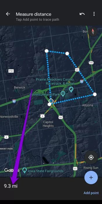
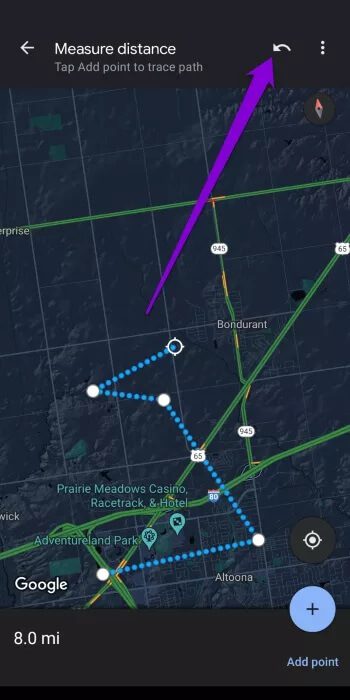
While selecting points, if you add a wrong point, you can remove it using the undo button at the top.
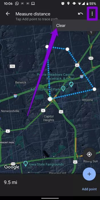
After measuring the distance, use the three-dot menu and choose Clear to remove the measured distance.
How to calculate area in Google Maps on a computer
In addition to measuring distance, the web version of Google Maps also lets you calculate the area of any location. Using it, you can measure the area of any property you might be interested in. Here's how it works.
Step 1: Open your favorite web browser and go to Google Maps.
Step 2: Zoom in on the location or property you want to measure. Now right-click on the map and select the Measure Distance option.
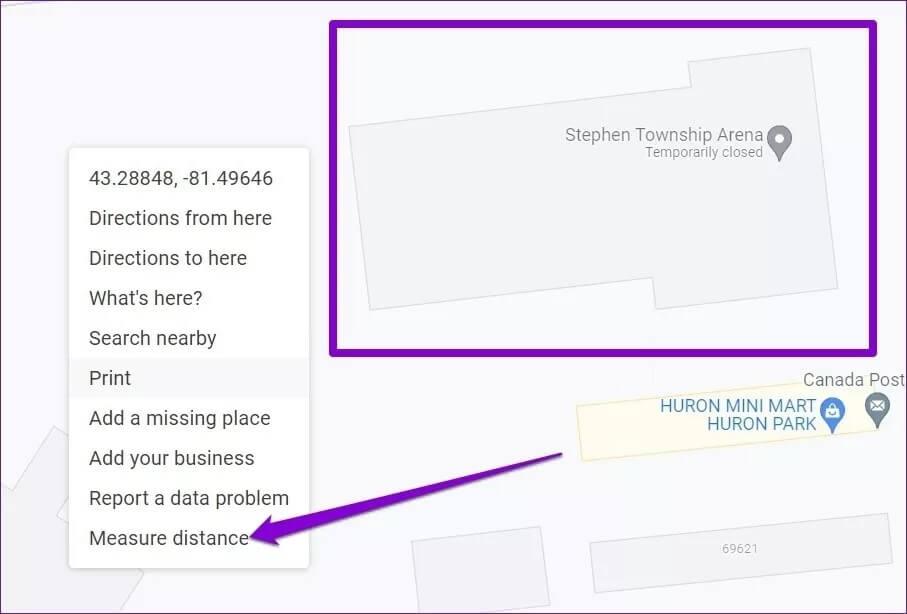
Step 3: Move the cursor to the starting point and select several points around the property's perimeter. Once you create a closed shape using these points, Google Maps will also display the area of that closed shape in square meters and square feet, along with the property's perimeter.
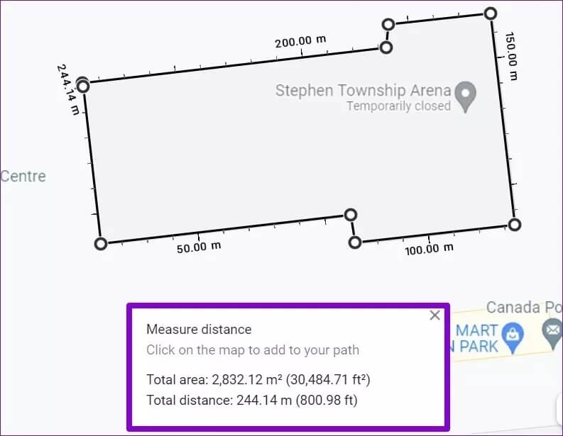
Similarly, you can also measure the area of your school, city, or even an island. All you have to do is create points along the boundaries of that property.
You can only measure area in the web version of Google Maps because it doesn't allow you to calculate area in the Google Maps app.
No to half-measures
While measuring distance and area in Google Maps isn't something you do every day, it's certainly a great feature. It certainly helps when measuring your daily walking, cycling, or hiking route.
Besides, did you know that you can navigate Google Maps without the internet? Learn how to download Google Maps and its offline use.


